 vesseltracker.com
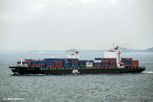
Vessel MAERSK INCHEON IMO: 9329629, MMSI: 477754800 Container Ship
UTC, 3.55051, -4.76528, course: 265, speed: 16.2
UTC, 3.51976, -5.04913, course: 265, speed: 16.4
2026-02-21 03:23:15 UTC, 3.51976, -5.04913, course: 265, speed: 16.4
Live AIS position:
UTC. 38 nm W of Malaga),
updated 2026-02-21 03:23:15 UTC.
Find the position of the vessel MAERSK INCHEON on the map. The latter are known coordinates and path.
marine traffic ship tracker show on live map
The current position of vessel MAERSK INCHEON is 3.51976 lat / -5.04913 lng. Updated: 2026-02-21 03:23:15 UTCCurrently sailing under the flag of Hong Kong, China
MAERSK INCHEON built in 2006 year
Deadweight:
42164 tDetails:
Last coordinates of the vessel:
UTC, 3.55051, -4.76528, course: 265, speed: 16.2UTC, 3.55051, -4.76528, course: 265, speed: 16.2
UTC, 3.51976, -5.04913, course: 265, speed: 16.4
2026-02-21 03:23:15 UTC, 3.51976, -5.04913, course: 265, speed: 16.4